Tqjxlm Atlas Save
An extensible 3D GIS application for visualization, analysis and research.
Atlas
Atlas is a 3D GIS visualization project that aims to combine some basic features of QGIS and Google Earth. It utilizes osgEarth to handle 2D maps and 3D models in the same space. It depends on Qt 5 to provide an customizable UI and provides a strong plugin system.
The main purpose of the project is to provide fancier and easier visualization of geographic applications, while supporting complicated analysis tasks and more advanced research purposes.
It has been tested on Windows 10, Fedora 28 and ubuntu 16.04.
Features
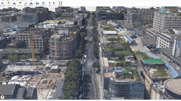
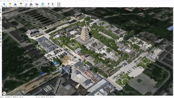
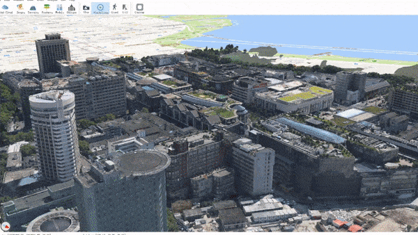
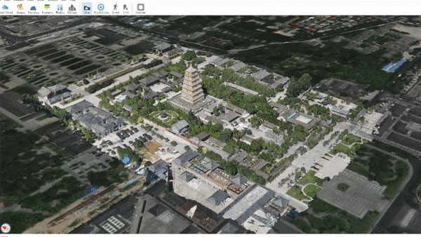
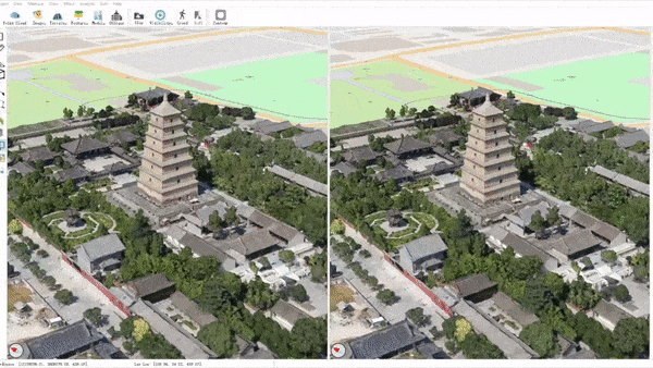
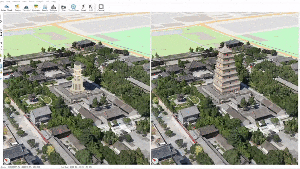
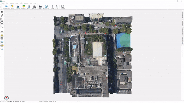
Large Scale 3D Models
Improved performance, interaction, and various analysis and measurement tools for:
- Oblique Imagery model
- dense point cloud
- other models supported by OSG
Geographic Data
Common geographic data formats and services are supported and fused together in the 3D space.
- local files: see GDAL raster and GDAL ogr
- raster services: XYZ tiles, TMS, WMS, ArcGIS services
- vector services: WFS, ArcGIS services
Coherent Data Api
Atlas provides a high level and uniform api for different data formats supported by OSG, osgEarth and custom plugins. For supported data formats please see:
- OpenSceneGraph formats
- osgEarth formats
- plugin extensions
Highly Extensible
Atlas is built upon plugins. It is easy to add new features to the main program or modify the existing behaviours with the help of plugins.
A full list of current plugins can be found at plugins.md.
Demos
The project is still under development, but a development release is provided so you can have a taste of it.
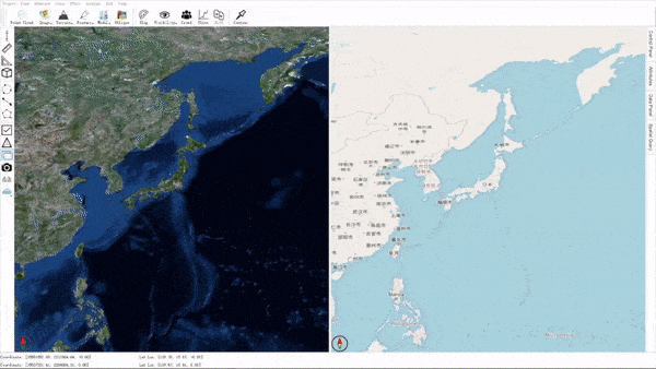
Geodetic & projected modes
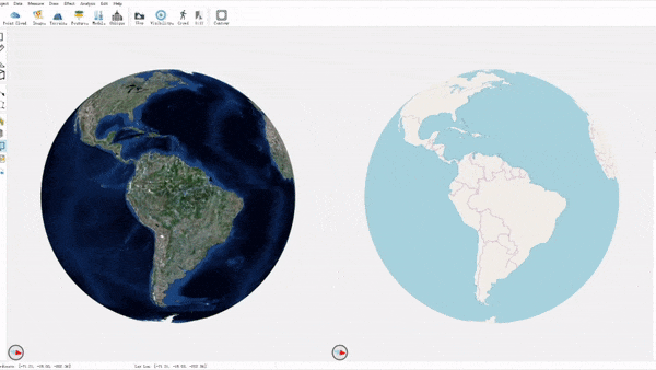
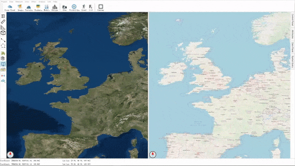
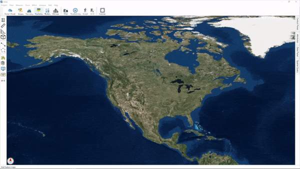
Online images & terrains
ShapeFile or Geo-features
Oblique imagery models

Draw & measure
Data management
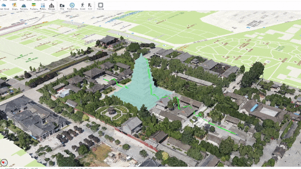
Visibility test
Slope grade visualization
Plan comparison (by editing oblique model and insert new models)
Orthographic generation (generate orthographic DOM and DSM for oblique model)
Contribute
This project is at a very early stage. The core code is far from being mature or stable, and the plugins need testing and maintenance. Also, since the project aims to mimic QGIS and Google Earth, more functionalities (plugins) are urgently and consistently needed.
If you are interested in or skilled at any of the following topics, we are most delightful if you can become a contributor:
- skills: C++, Qt, OSG, OSGEarth, OpenGL
- topics: desktop app, visualization, UI
- research: GIS, CG, CV
Getting started
You can get started following these steps:
- try out the dev release
- build from source
- read the project structure
- find your interested task on trello board or put up a new idea
- fork the project, finish coding and commit a PR
If you want to write a new plugin, see plugin_guide.md.
Dev Resources
Contact
You are welcome to give feedbacks on issues page, or just contact us via [email protected].
We manage the project progress on trello where you can also request for features and report bugs.
