Proximityhash Save
Geohashes in proximity
.. image:: http://donatecoins.org/btc/1HeMeMU2qUFDRZpRQMJ2v27Dw3h3gShJ5b.svg :target: http://donatecoins.org/btc/1HeMeMU2qUFDRZpRQMJ2v27Dw3h3gShJ5b
ProximityHash: Geohashes in Proximity (with the option of compression using Georaptor_)
.. _GeoRaptor: https://github.com/ashwin711/georaptor
Geohash is a geocoding system invented by Gustavo Niemeyer and placed into the public domain. It is a hierarchical spatial data structure which subdivides space into buckets of grid shape, which is one of the many applications of what is known as a Z-order curve, and generally space-filling curves.
ProximityHash generates a set of geohashes that cover a circular area, given the center coordinates and the radius. It also has an additional option to use GeoRaptor that creates the best combination of geohashes across various levels to represent the circle, starting from the highest level and iterating till the optimal blend is brewed. Result accuracy remains the same as that of the starting geohash level, but data size reduces considerably, thereby improving speed and performance.
Usage
::
$ proximityhash -h
::
usage: proximityhash [-h] [--georaptor GEORAPTOR] [--minlevel MINLEVEL] [--maxlevel MAXLEVEL] latitude longitude radius precision_level
positional arguments: latitude latitude of the center point longitude longitude of the center point radius radius of coverage in metres precision_level geohash precision level
optional arguments: -h, --help show this help message and exit --georaptor GEORAPTOR georaptor flag to compress the output (default: false) --minlevel MINLEVEL minimum level of geohash if georaptor set to true(default: 1) --maxlevel MAXLEVEL maximum level of geohash if georaptor set to true(default: 12)
Example
::
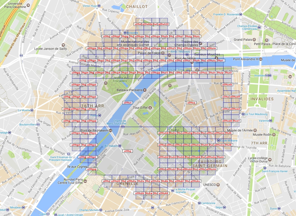
$ proximityhash 48.858156 2.294776 1000 7
.. image:: https://raw.github.com/ashwin711/proximityhash/master/images/proximityhash.png :width: 480 :height: 320
::
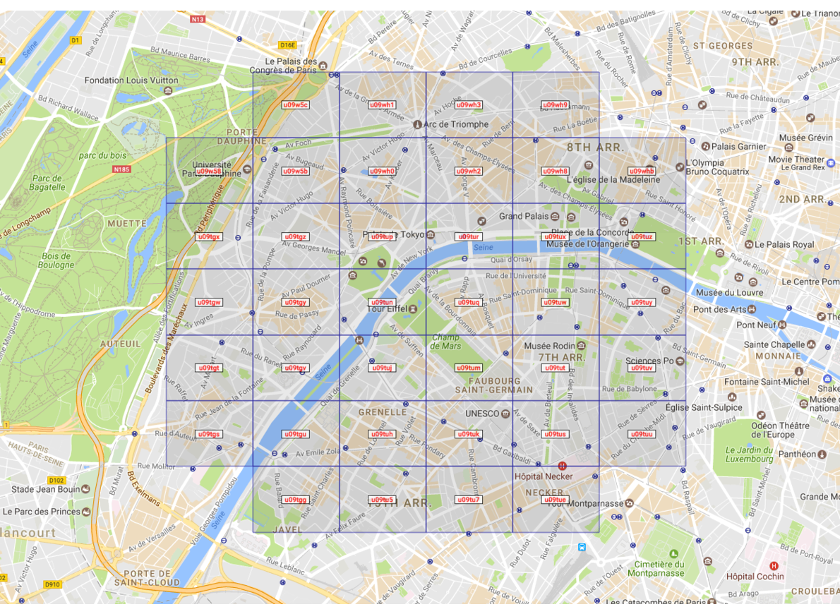
$ proximityhash 48.858156 2.294776 2000 7 --georaptor true
.. image:: https://raw.github.com/ashwin711/proximityhash/master/images/proximityhash_georaptor.png :width: 480 :height: 320
::
$ proximityhash 48.858156 2.294776 2000 7 --georaptor true --minlevel 3 --maxlevel 6
.. image:: https://raw.github.com/ashwin711/proximityhash/master/images/proximityhash_georaptor_limited.png :width: 480 :height: 320
Installation
To install proximityhash, simply: ::
$ pip install proximityhash
License:
Licensed under the Apache License, Version 2.0. ::
Copyright 2017 Ashwin Nair <https://www.linkedin.com/in/nairashwin7>
Licensed under the Apache License, Version 2.0 (the "License"); you may not use this file except in compliance with the License. You may obtain a copy of the License at
http://www.apache.org/licenses/LICENSE-2.0
Unless required by applicable law or agreed to in writing, software distributed under the License is distributed on an "AS IS" BASIS, WITHOUT WARRANTIES OR CONDITIONS OF ANY KIND, either express or implied. See the License for the specific language governing permissions and limitations under the License.
Contributors:
- Ashwin Nair [https://github.com/ashwin711]
- Arjun Menon - [http://github.com/arjunmenon92]
