Bburns Arda Save
Maps of J. R. R. Tolkien's Middle Earth using DEM (Digital Elevation Model) and place vectors
Arda
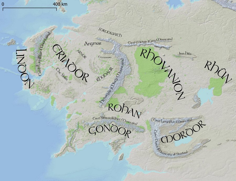
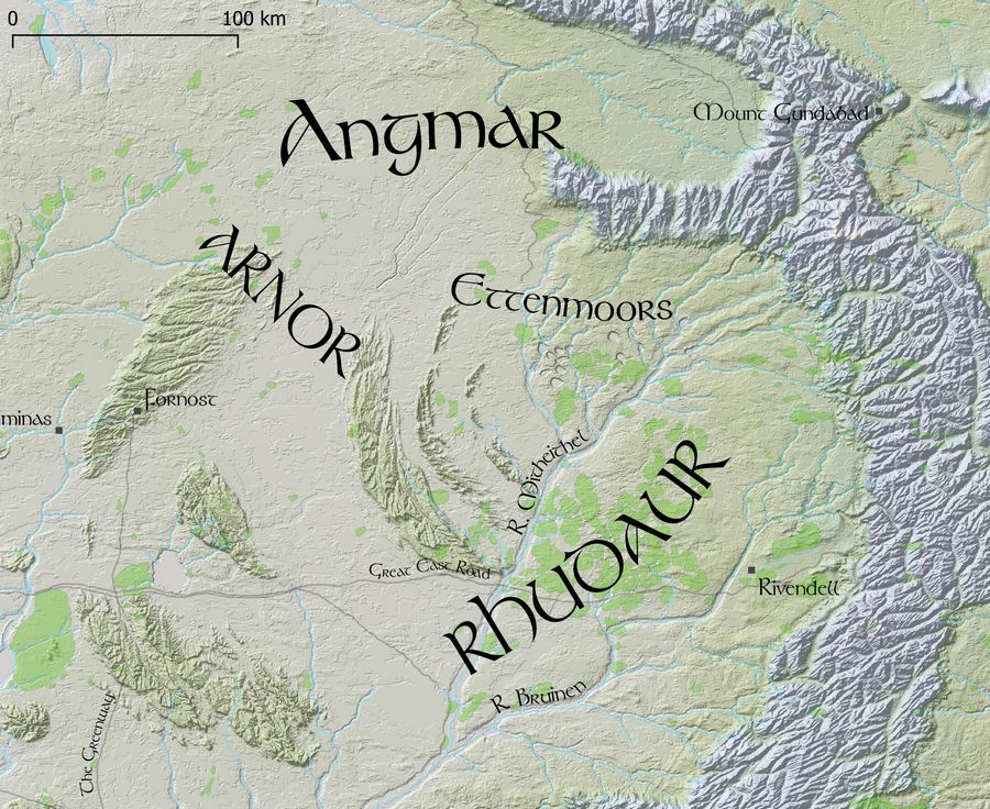
Maps of J. R. R. Tolkien's Middle Earth, using a DEM (Digital Elevation Model) and place name vectors.
Arda was the name of the entire world, which included the part known as Middle Earth.
Goals
- Make colored elevation maps with hillshading
- Make name placement and size similar to Tolkien's maps
- Use as detailed maps for Adventures in Middle Earth (D&D 5e) games
Data
The DEM is stored in a 10k x 10k jpg file, made by monks and Redrobes on the Outerra Worlds Forum. The process apparently included some real-world 3d elevation data, hand-editing, and simulated erosion. Somewhere they also have a 40k x 40k DEM (50m/px) version.
The vector data includes place names, rivers, forests, mountains - made by monks, SeerBlue, and Redrobes, and maintained by jvangeld here - https://github.com/jvangeld/ME-GIS. I added the curved Tolkienesque labels and colored the different elevations.
The entire map covers 2000km on each axis, so the resolution of the DEM is 200m/px.
The file data/rasters/10K.wld defines how the DEM corresponds to the map coordinate system as used by the vector data. This is currently slightly off - improvements could be made.
Installing
Clone this repo
git clone https://github.com/bburns/arda.git
cd arda
Clone ME-GIS to the data/vectors subdirectory
git clone https://github.com/jvangeld/ME-GIS data/vectors
Get the Tolkien font here - https://fontzone.net/font-details/tolkien
Install QGIS
Open arda.qgs in QGIS
Build the hillshade layer - Raster / Analysis / Hillshade - enter a z-factor of 100.0 and click Run. Then adjust the global opacity of the layer to 50% - Layer Styling sidebar / Transparency / Global Opacity. This builds a ~100MB TIFF file in a temp folder so is not included in the repo.
Todo
- Add river sizes in meters and render widths accordingly
- Make map views for the Hobbit (overview, The Shire, Eriador, Misty Mountains, Mirkwood)
- Make map views for The Lord of the Rings corresponding to travels
- Explain QGIS and pull requests for shapefile data in readme
- Switch easily between colorful and minimal color versions - how do?
- Get access to 40k x 40k DEM (50m/px) version
- Render to tiles for Google Maps-like site, using Leaflet - try vector map tiles and mapboxGL? include search index
License
My contribution (labels and coloring) is MIT. The 3d DEM data/jpg is more uncertain - you'd need to find monks and Redrobes to know for sure.
