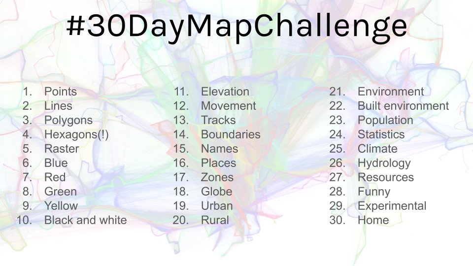
30DayMapChallenge2019 Save
My contributions to the #30DayMapChallenge 2019, a daily challenge focusing on spatial visualizations happening throughout November.
#30DayMapChallenge 2019
![]()
![]()
![]()
![]()
![]()
![]()
![]()
My contributions to the first #30DayMapChallenge initiated by Topi Tjukanov.
List of All Contributions (click to expand)
- Day 1: Points
- Day 2: Lines
- Day 3: Polygons
- Day 4: Hexagons
- Day 5: Raster
- Day 6: Blue
- Day 7: Red
- Day 8: Green
- Day 9: Yellow
- Day 10: Black & White
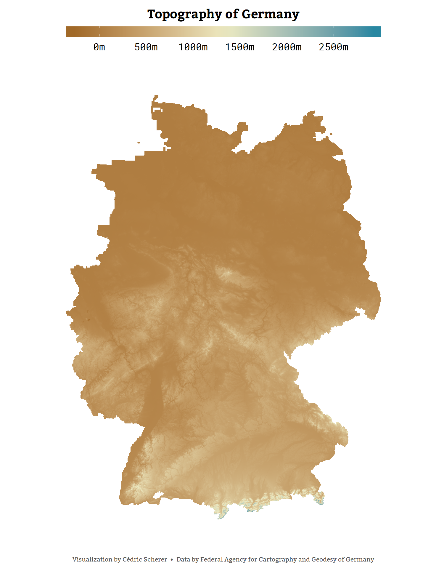
- Day 11: Elevation
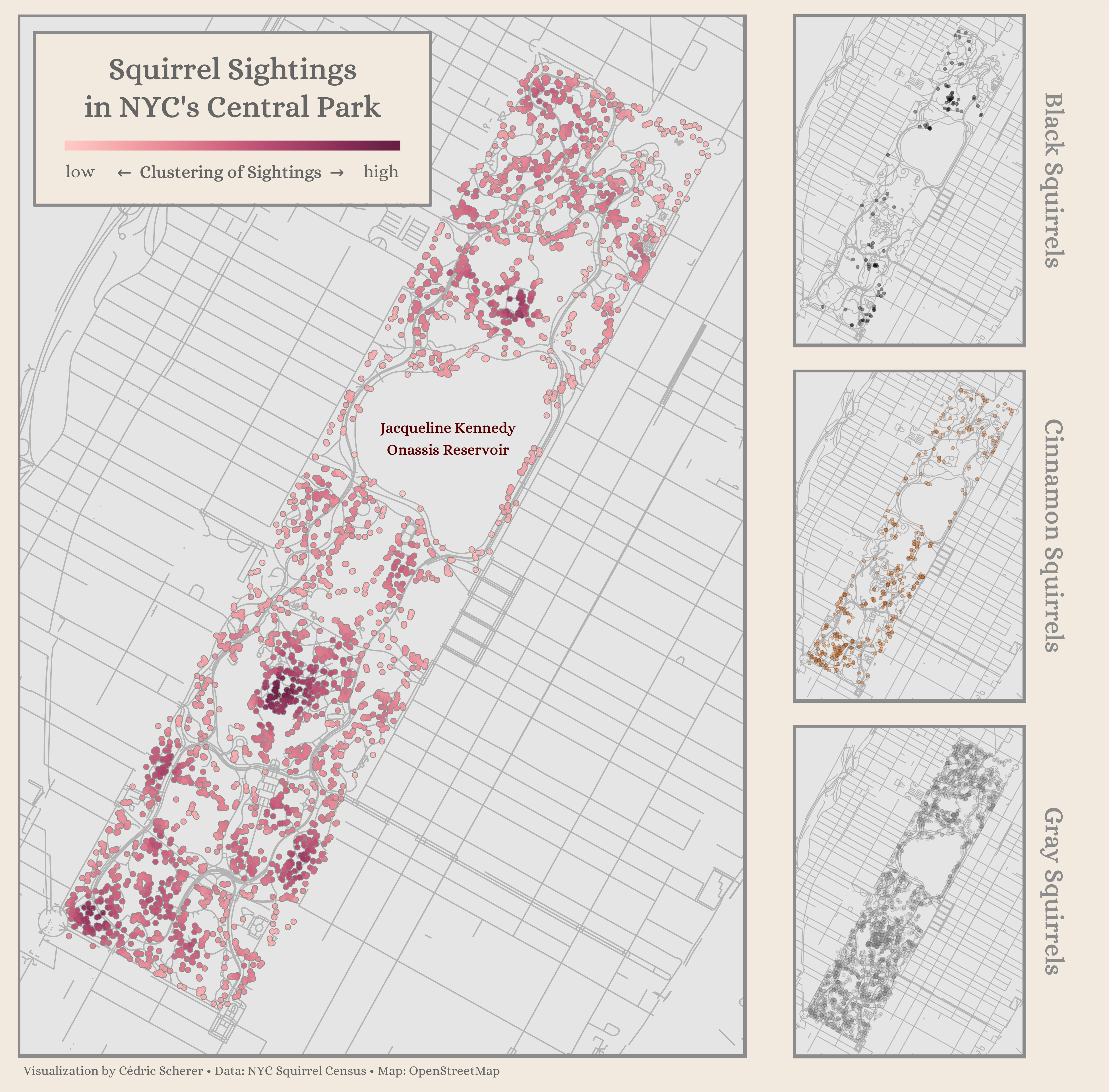
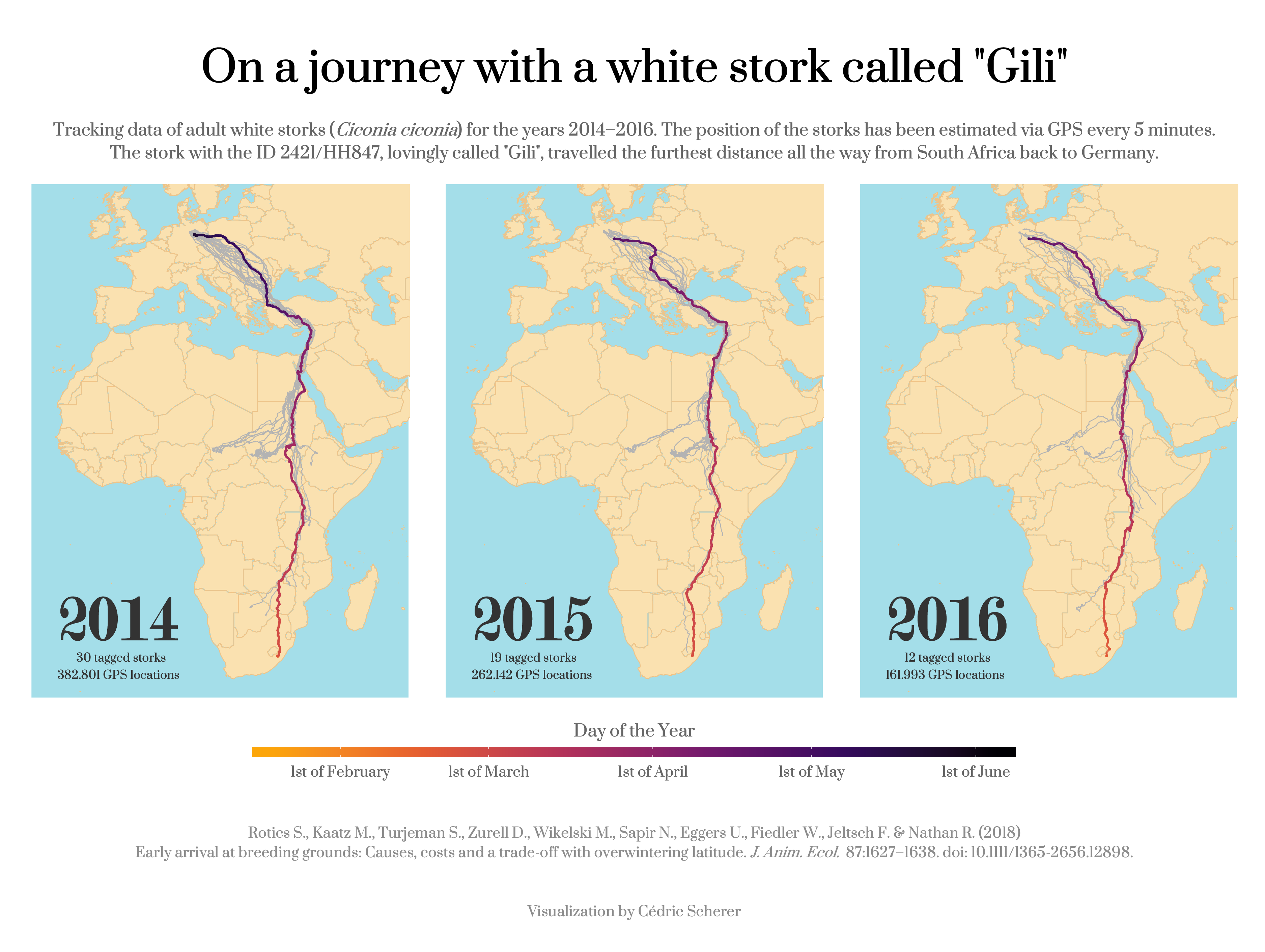
- Day 12: Movement
- Day 13: Tracks
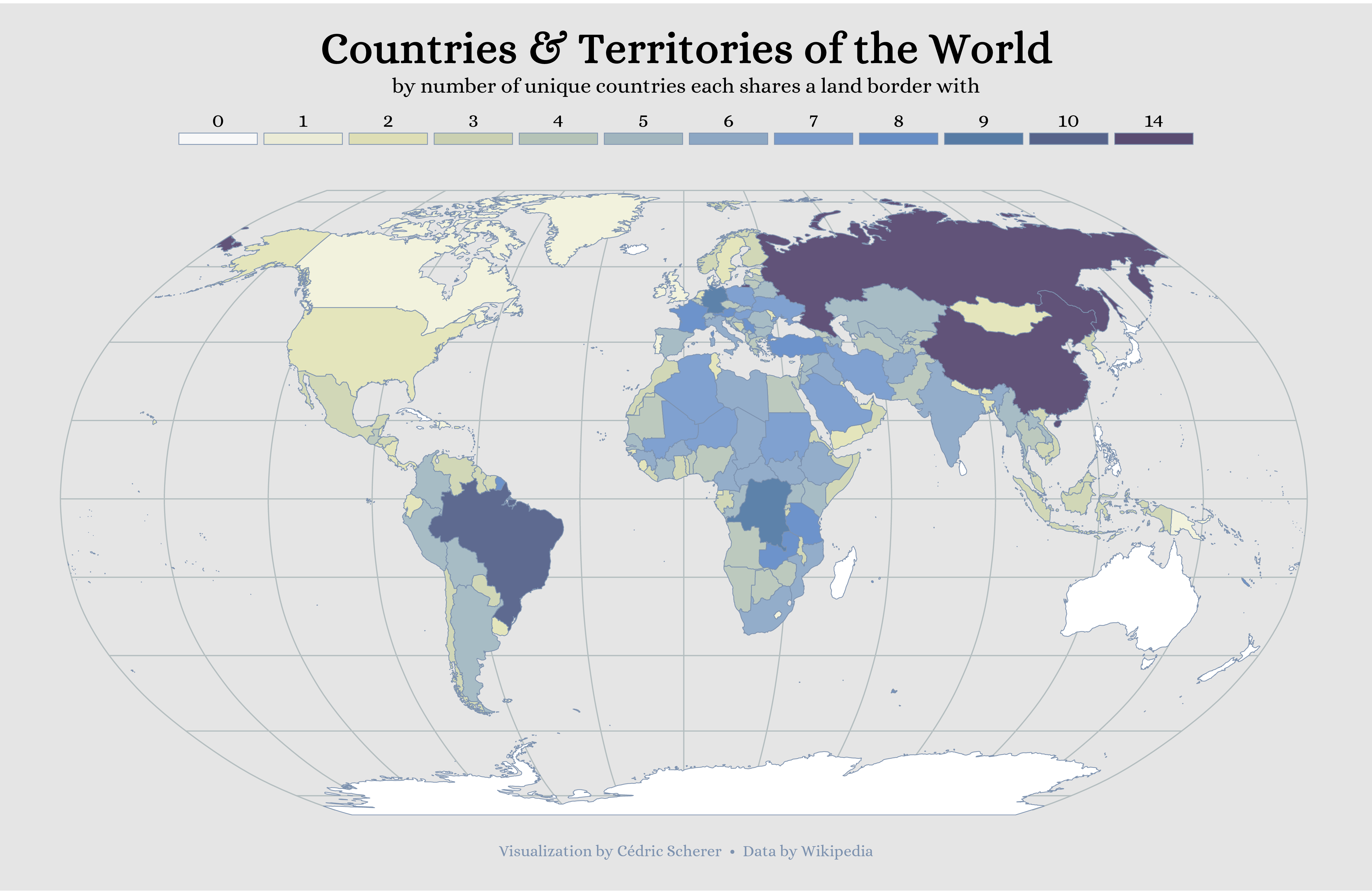
- Day 14: Boundaries
- Day 15: Names
- Day 16: Places
- Day 17: Zones
- Day 18: Globe
- Day 19: Urban
- Day 20: Rural
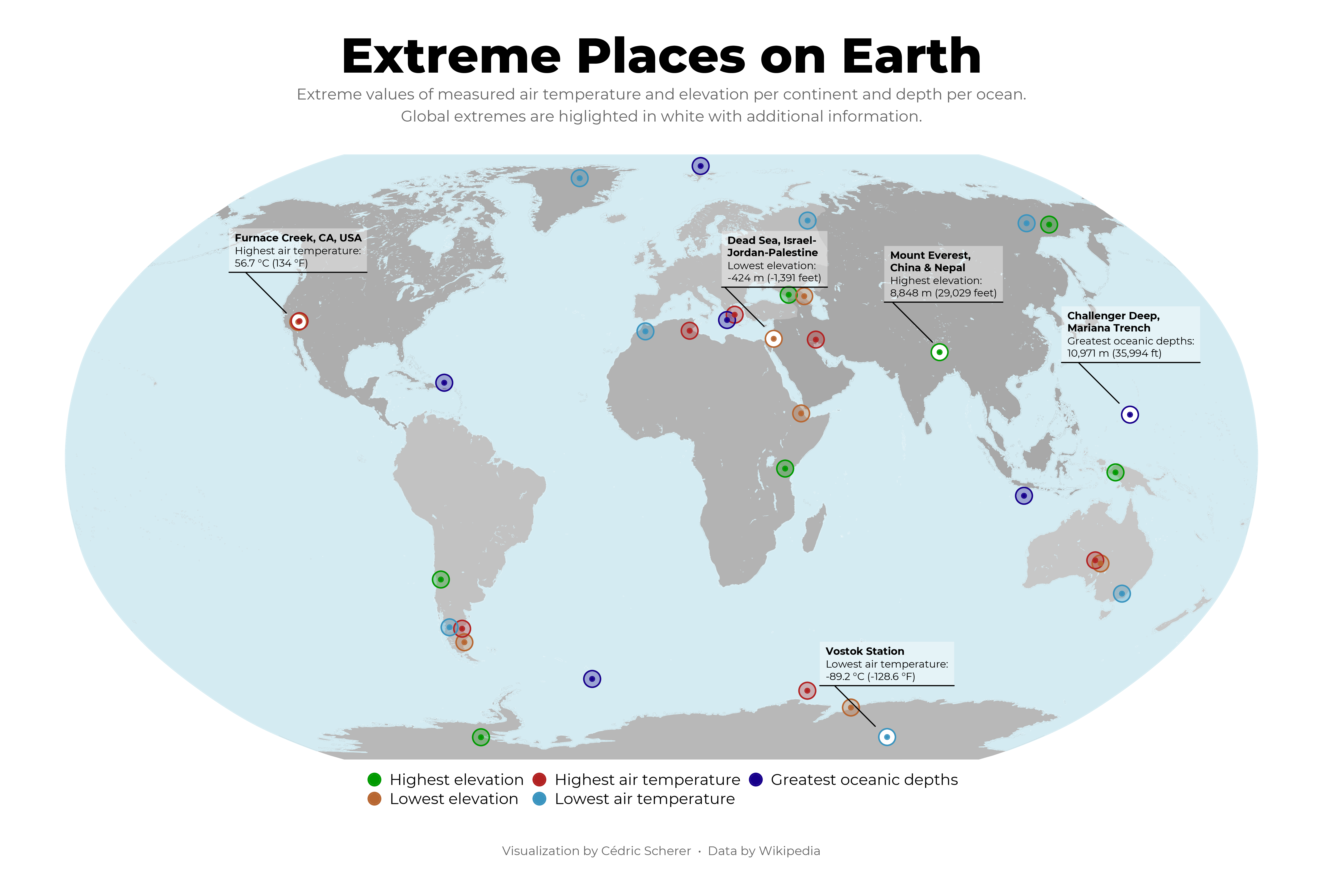
- Day 21: Environment
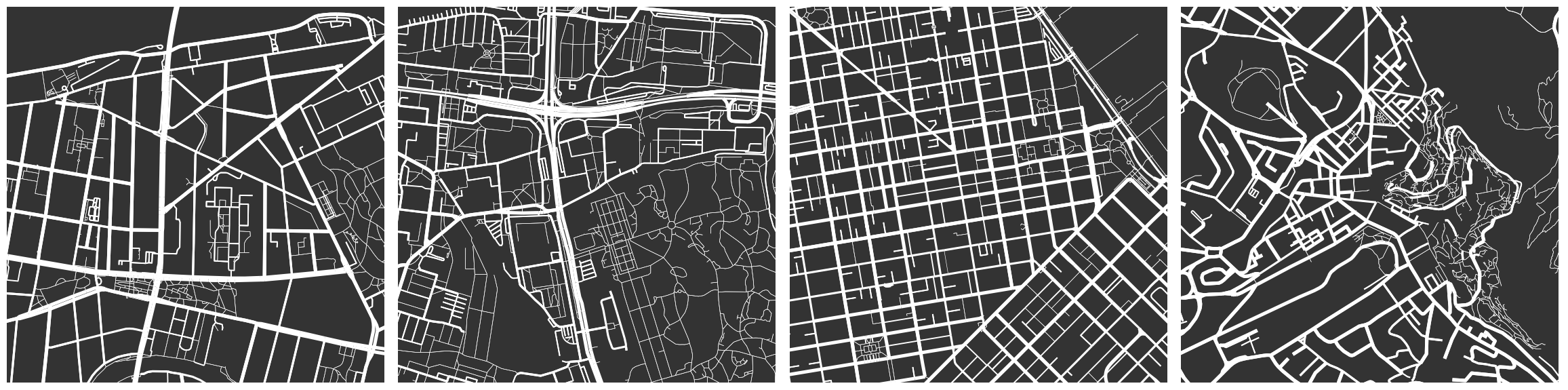
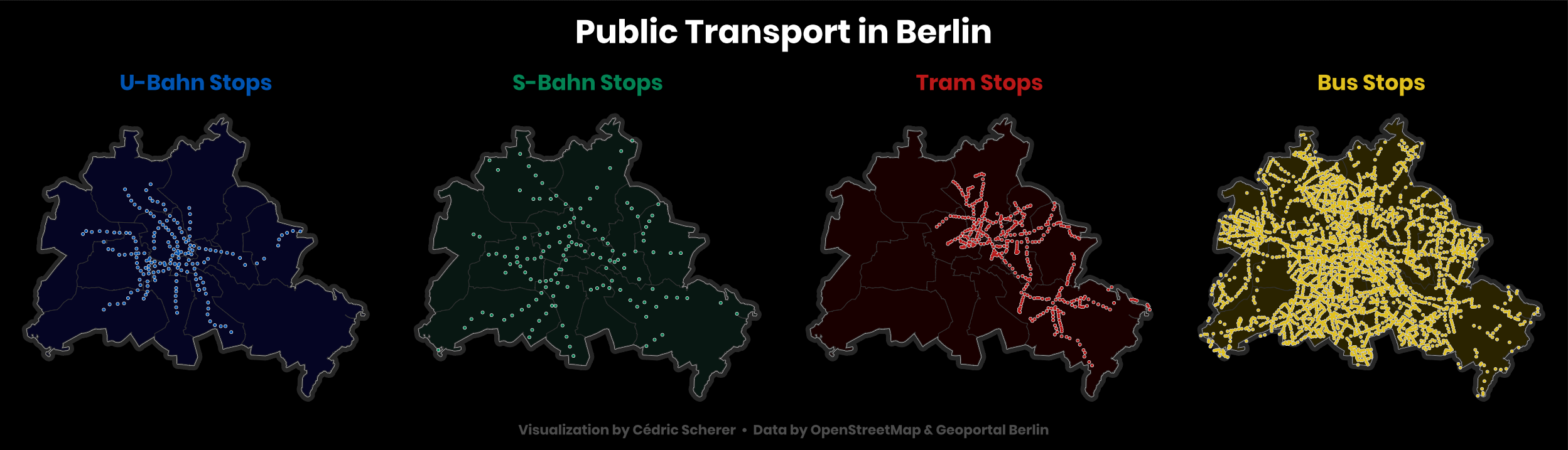
- Day 22: Built Environment
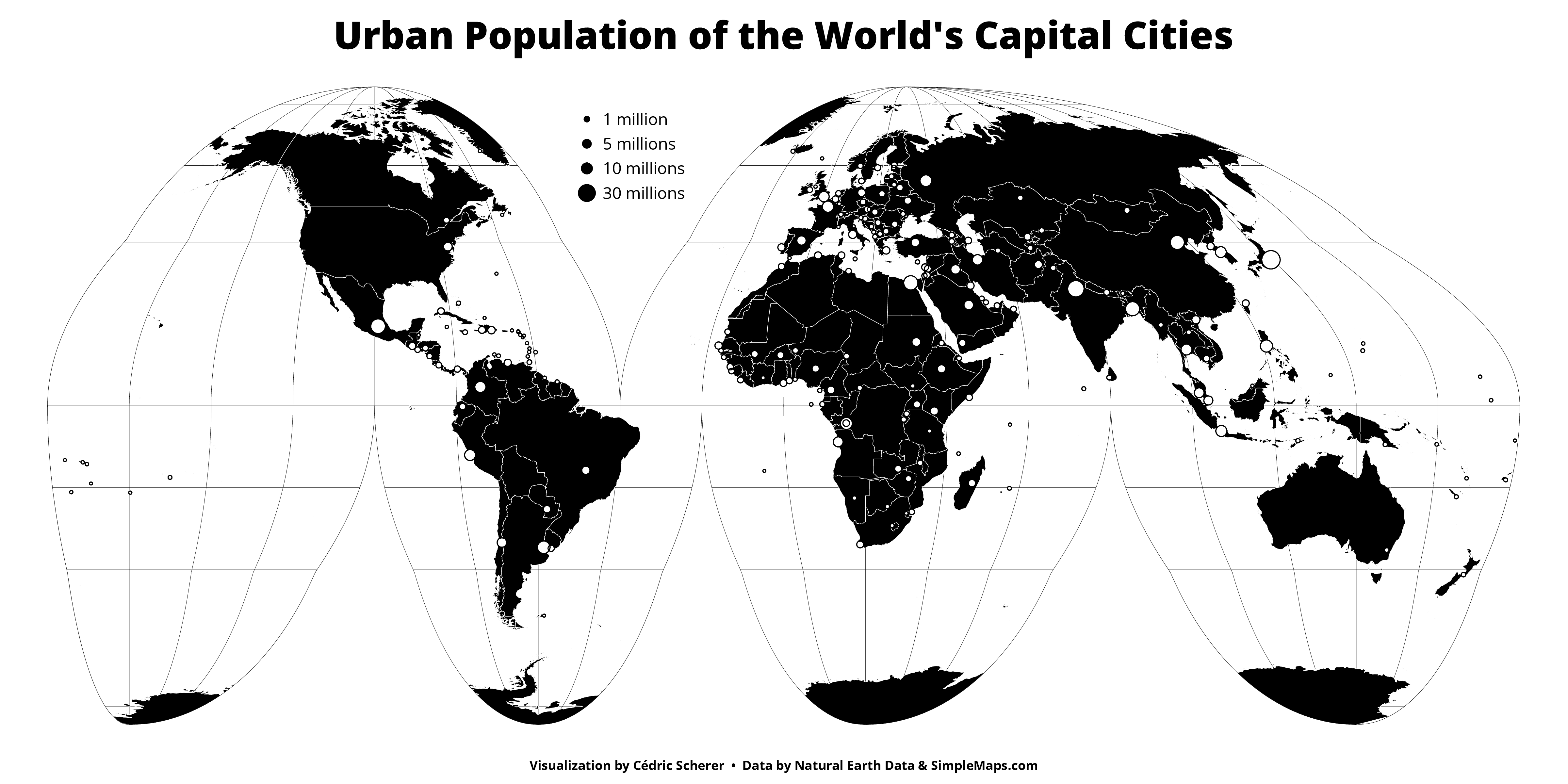
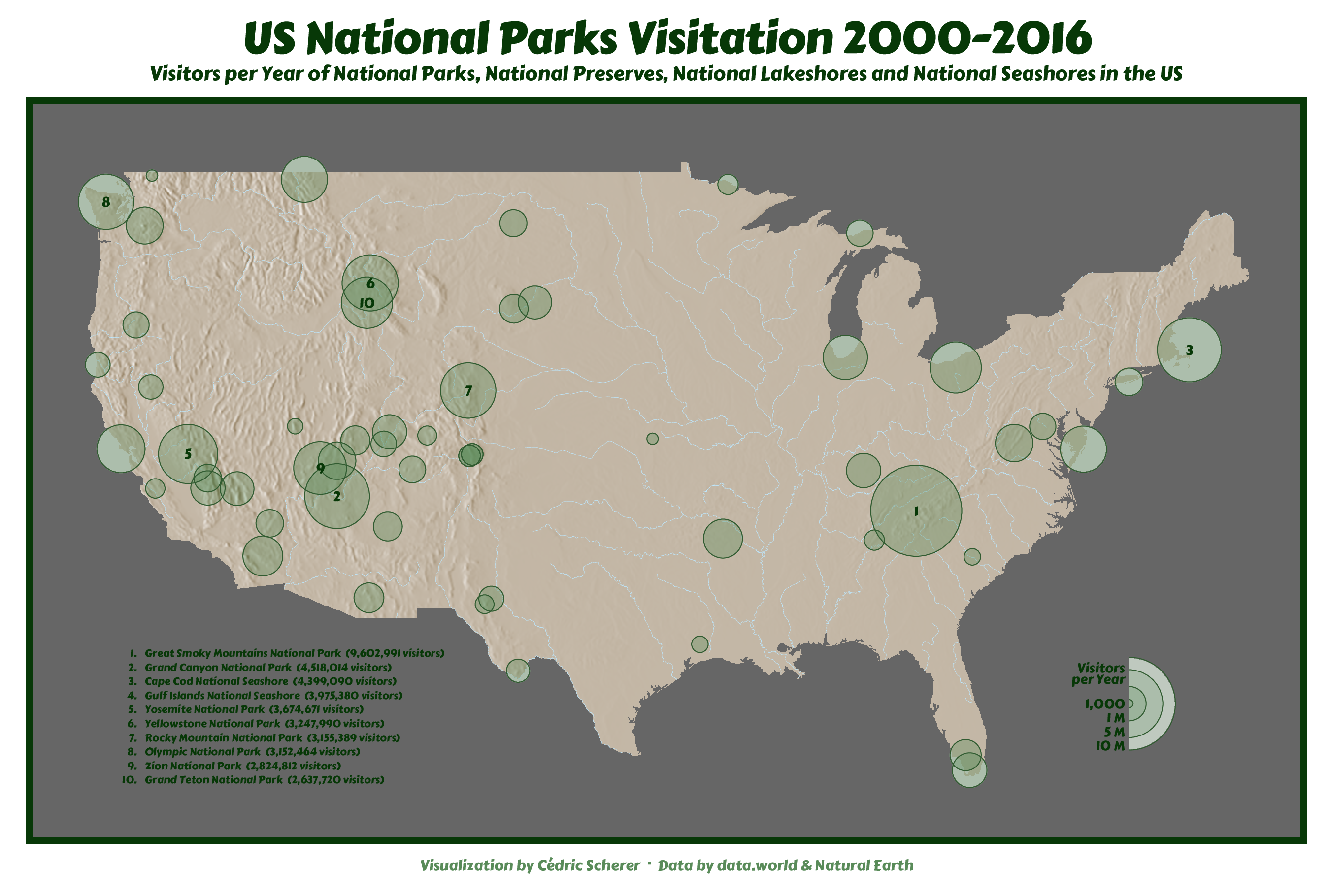
- Day 23: Population
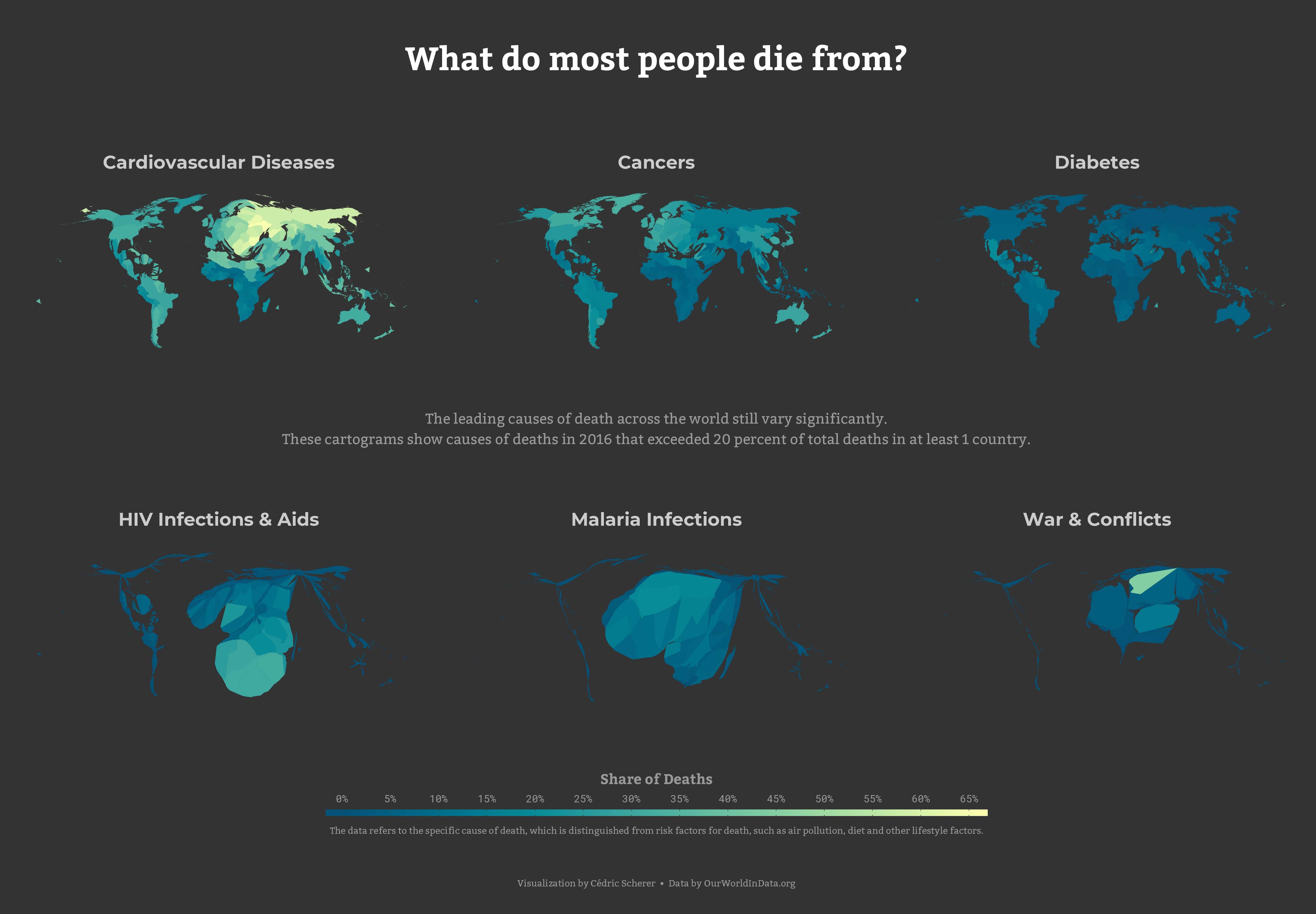
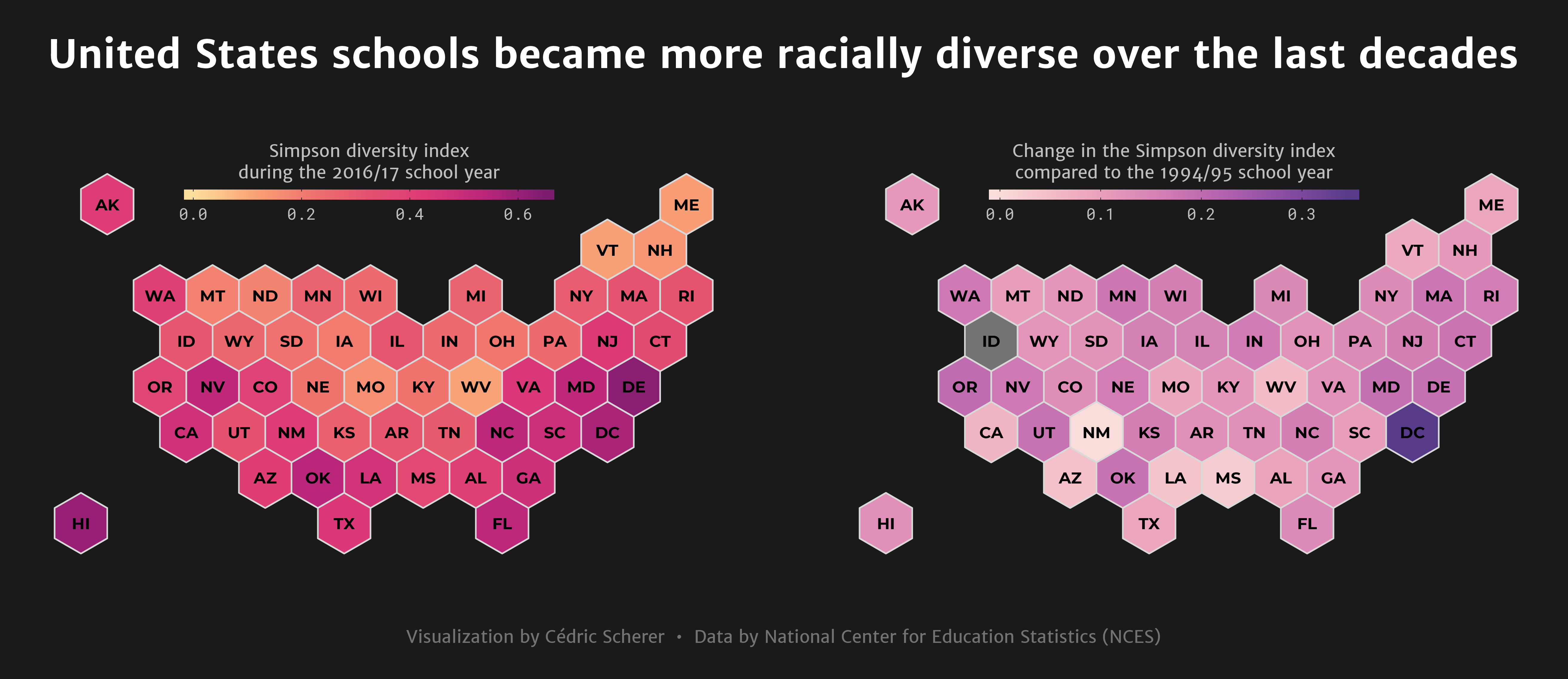
- Day 24: Statistics
- Day 25: Climate
- Day 26: Hydrology
- Day 27: Resources
- Day 29: Experimental
Day 1: Points
Day 2: Lines
Day 3: Polygons
... and a version showing deaths due to alcohol and drug disorder
Day 4: Hexagons
Day 5: Raster
Days 6 to 9: Blue, Green, Red & Yellow
Day 6: Blue | Day 7: Red | Day 8: Green | Day 9: Yellow
Day 10: Black & White
... and a version with some grey
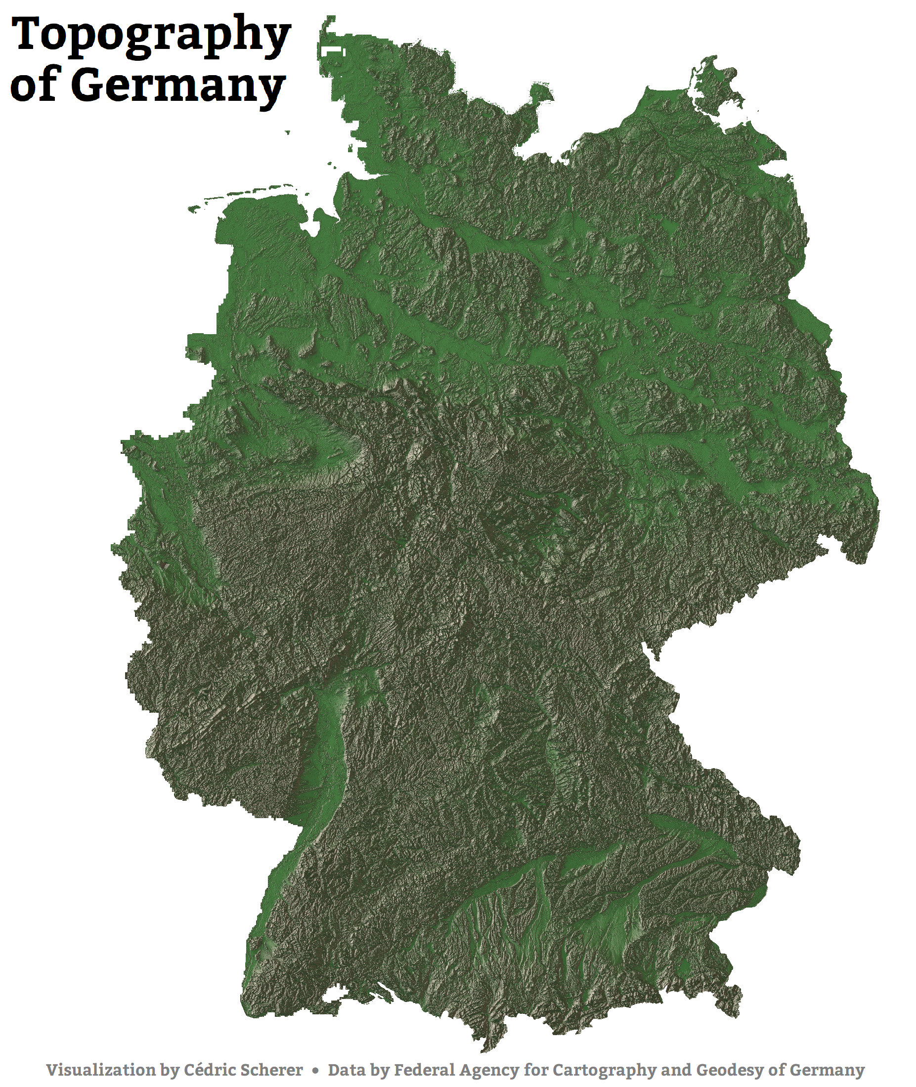
Day 11: Elevation
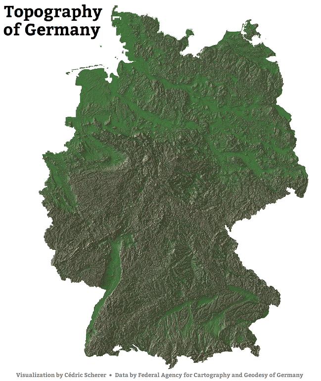
Here is the high resolution version and another version using a different custom texture palette
Day 12: Movement

Day 13: Tracks
Day 14: Boundaries
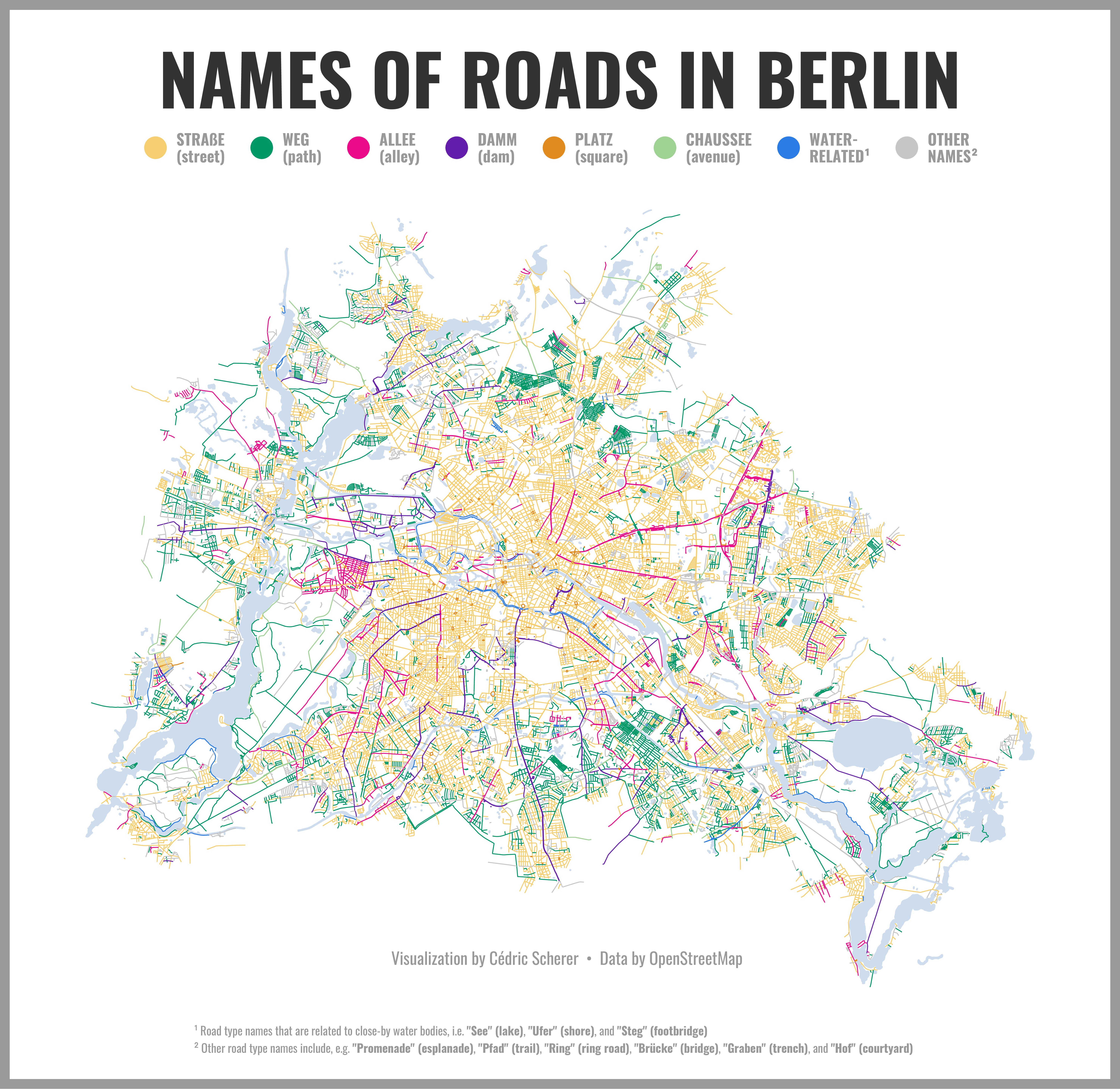
Day 15: Names
 Here is the high resolution version
Day 16: Places
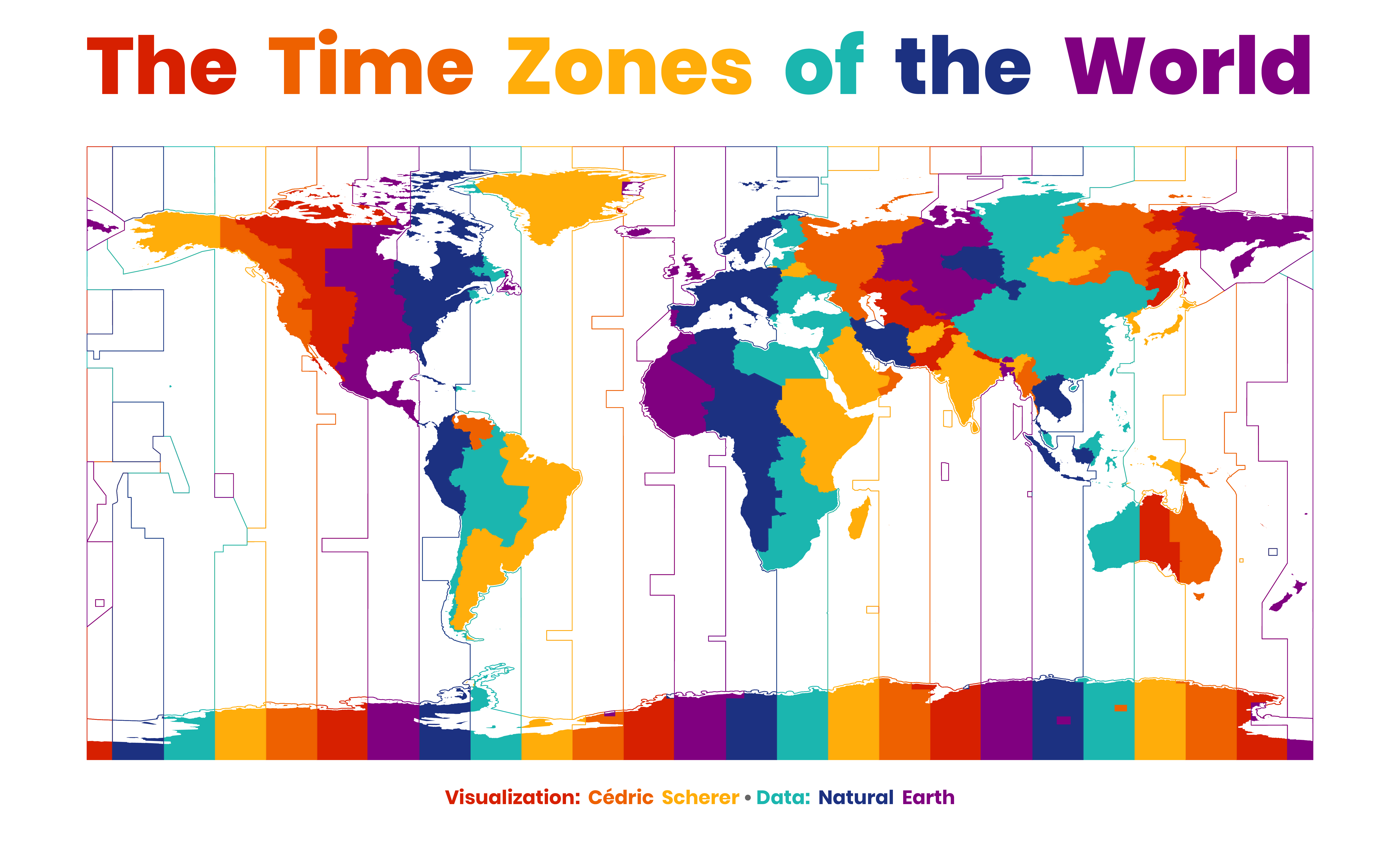
Day 17: Zones
 ... and another version with filled countries only
Day 18: Globe
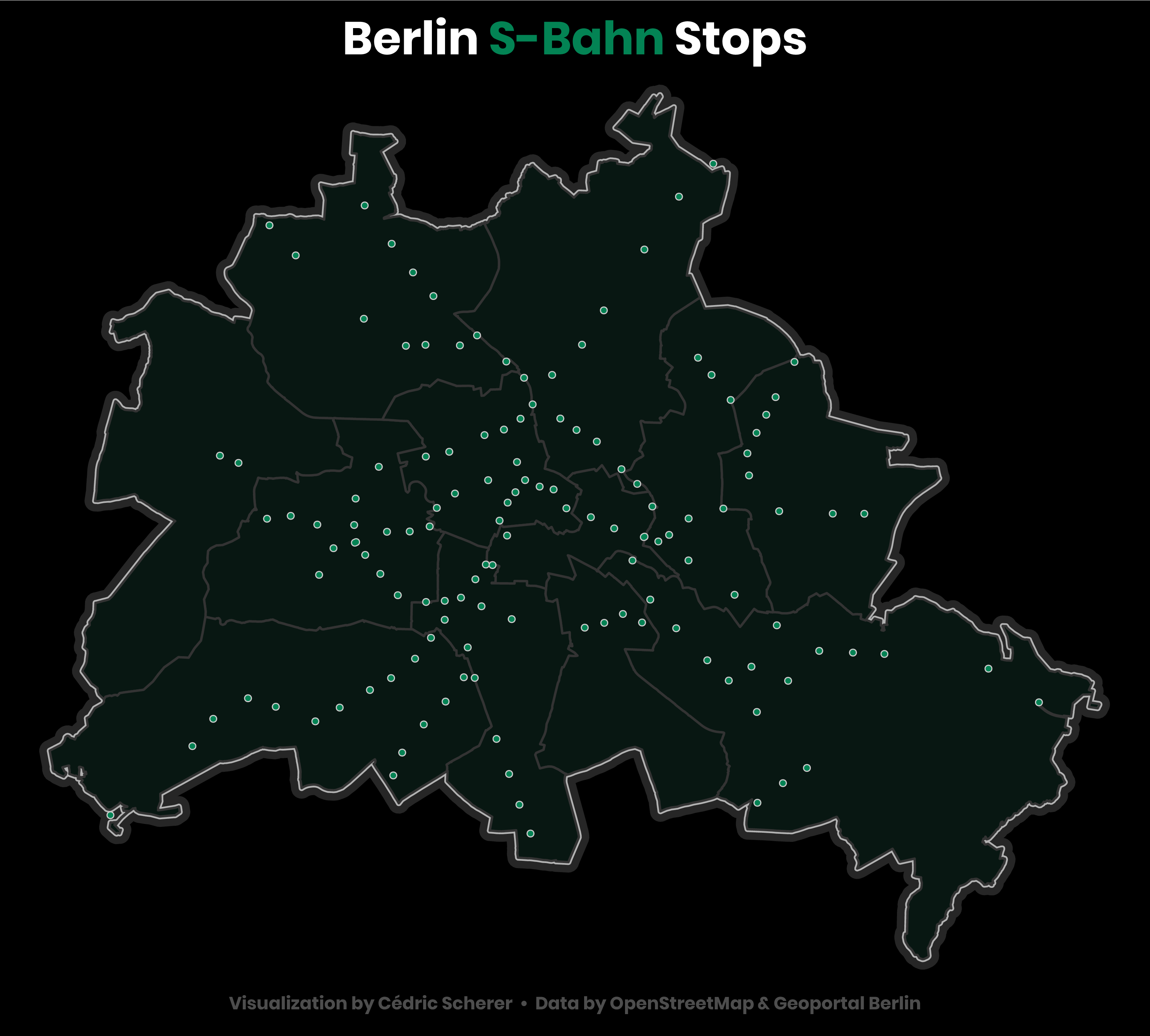
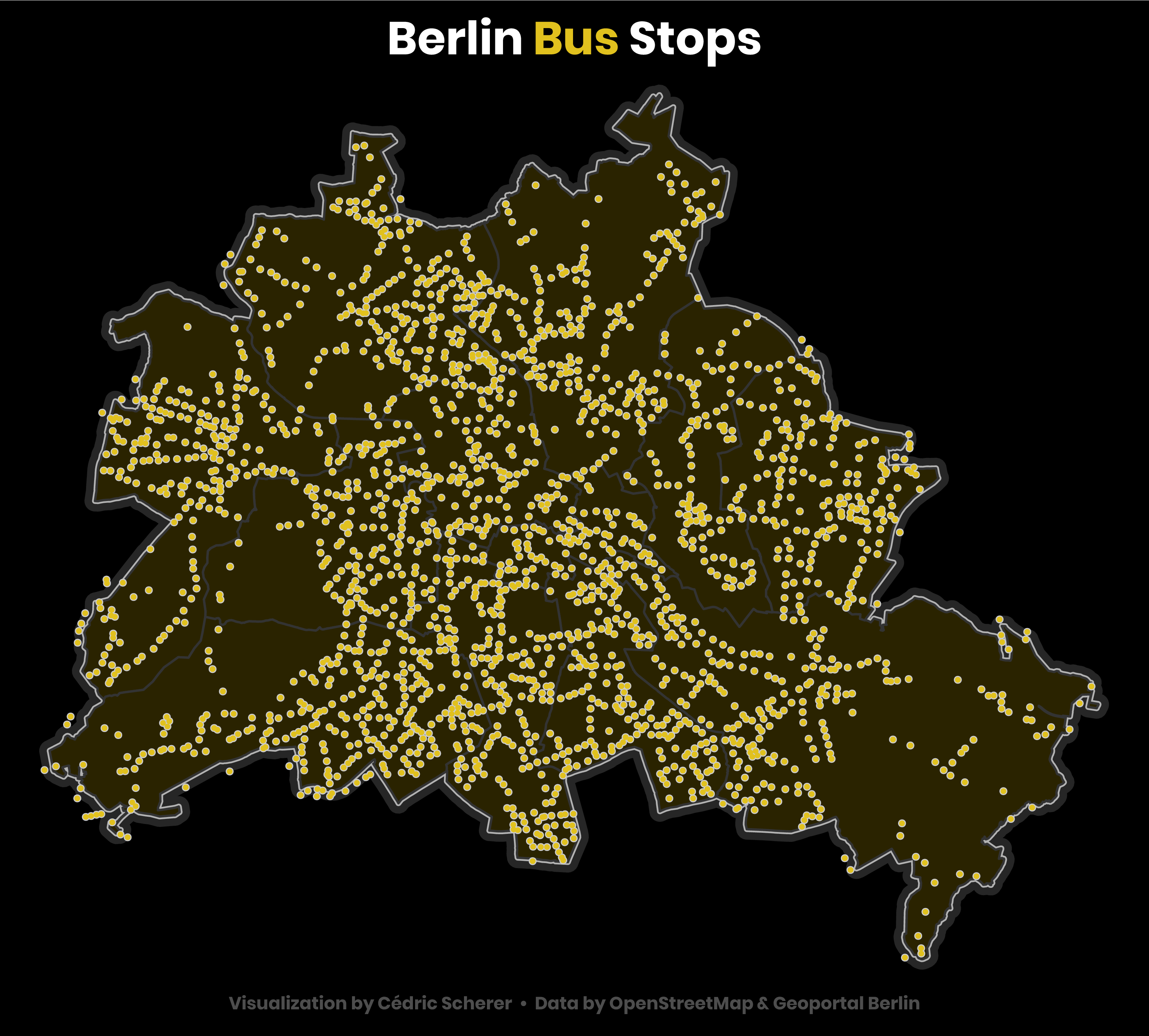
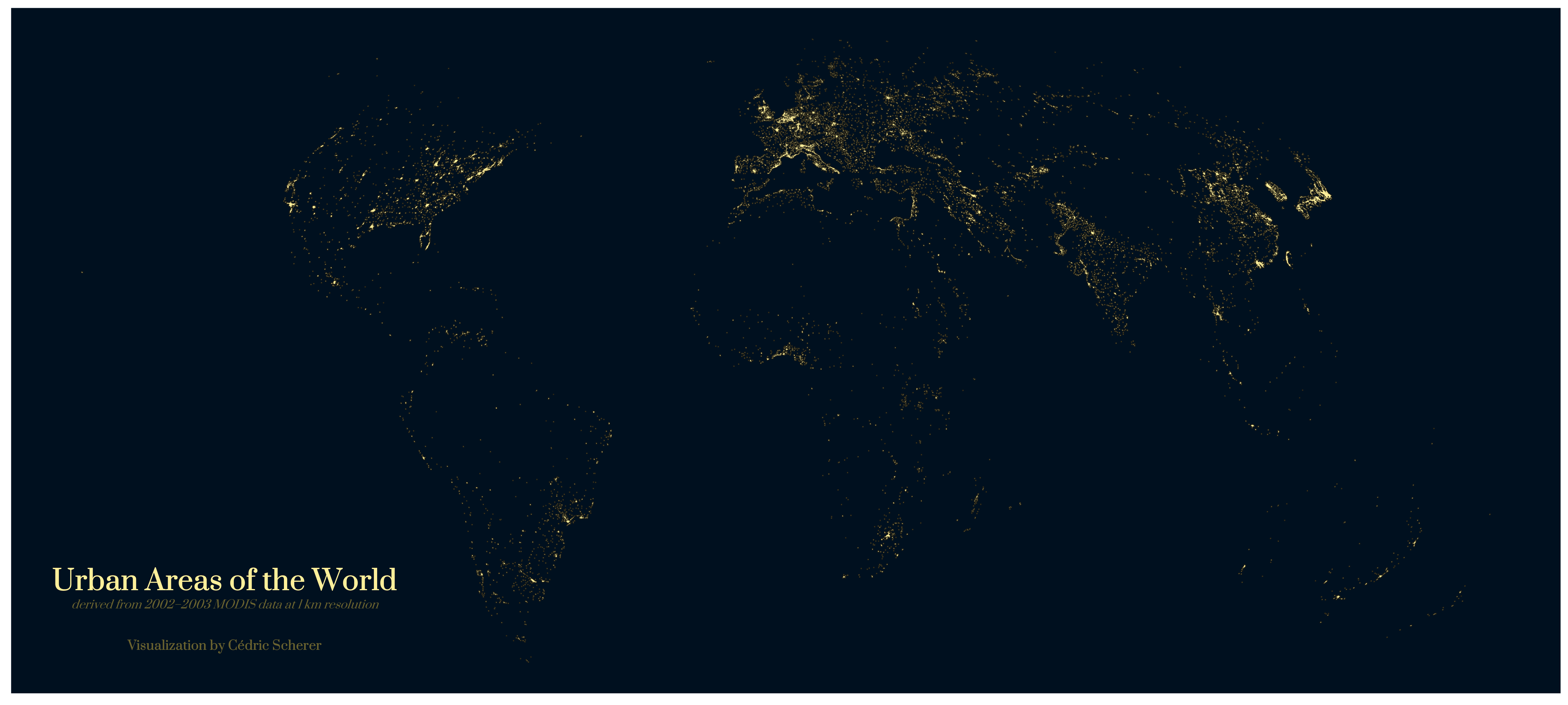
Day 19: Urban
... and another version of the "light map" without land masses
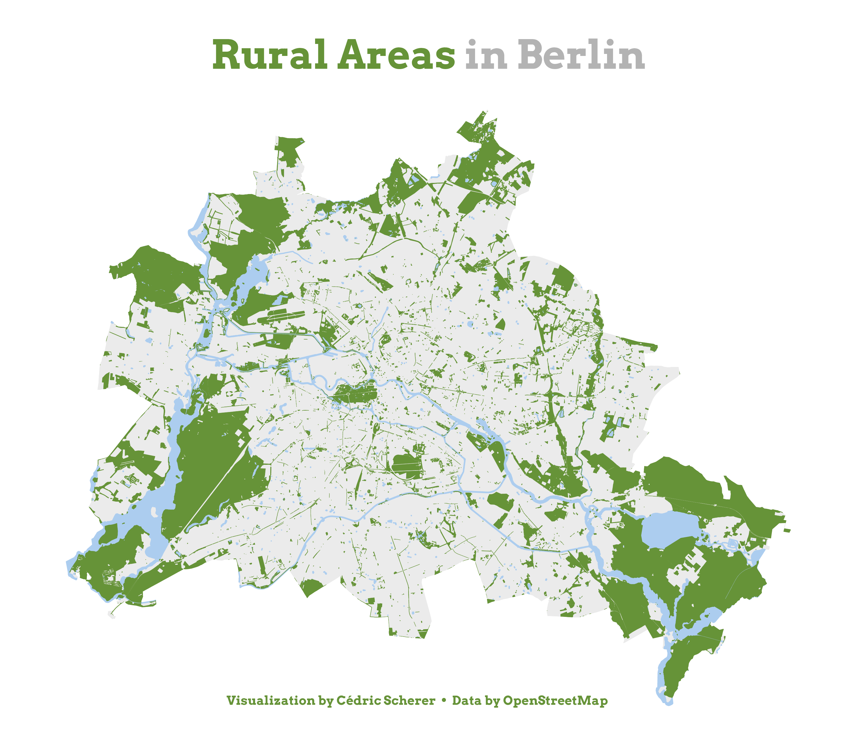
Day 20: Rural
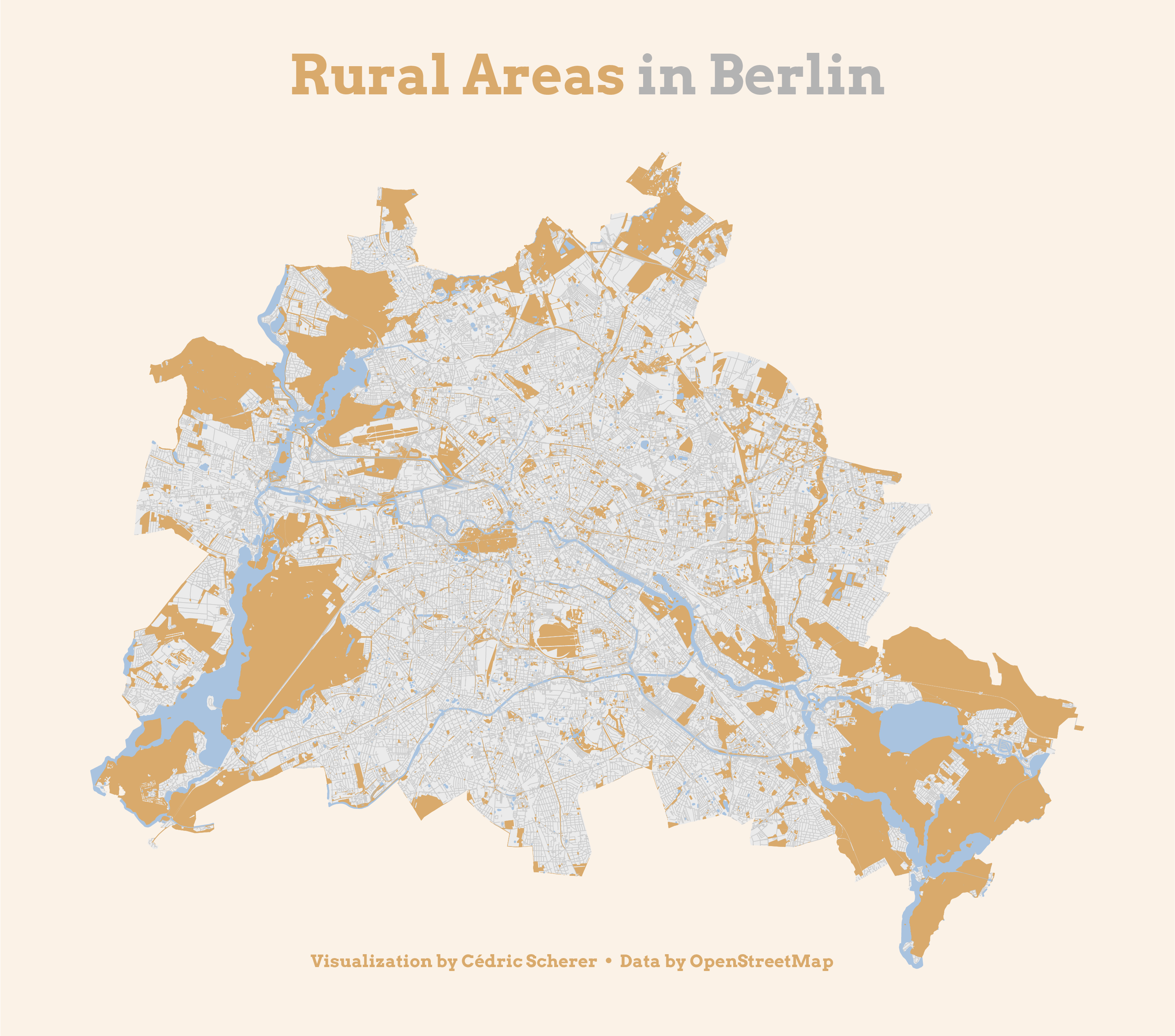 ... and a green version without roads
Day 21: Environment
Day 22: Built Environment
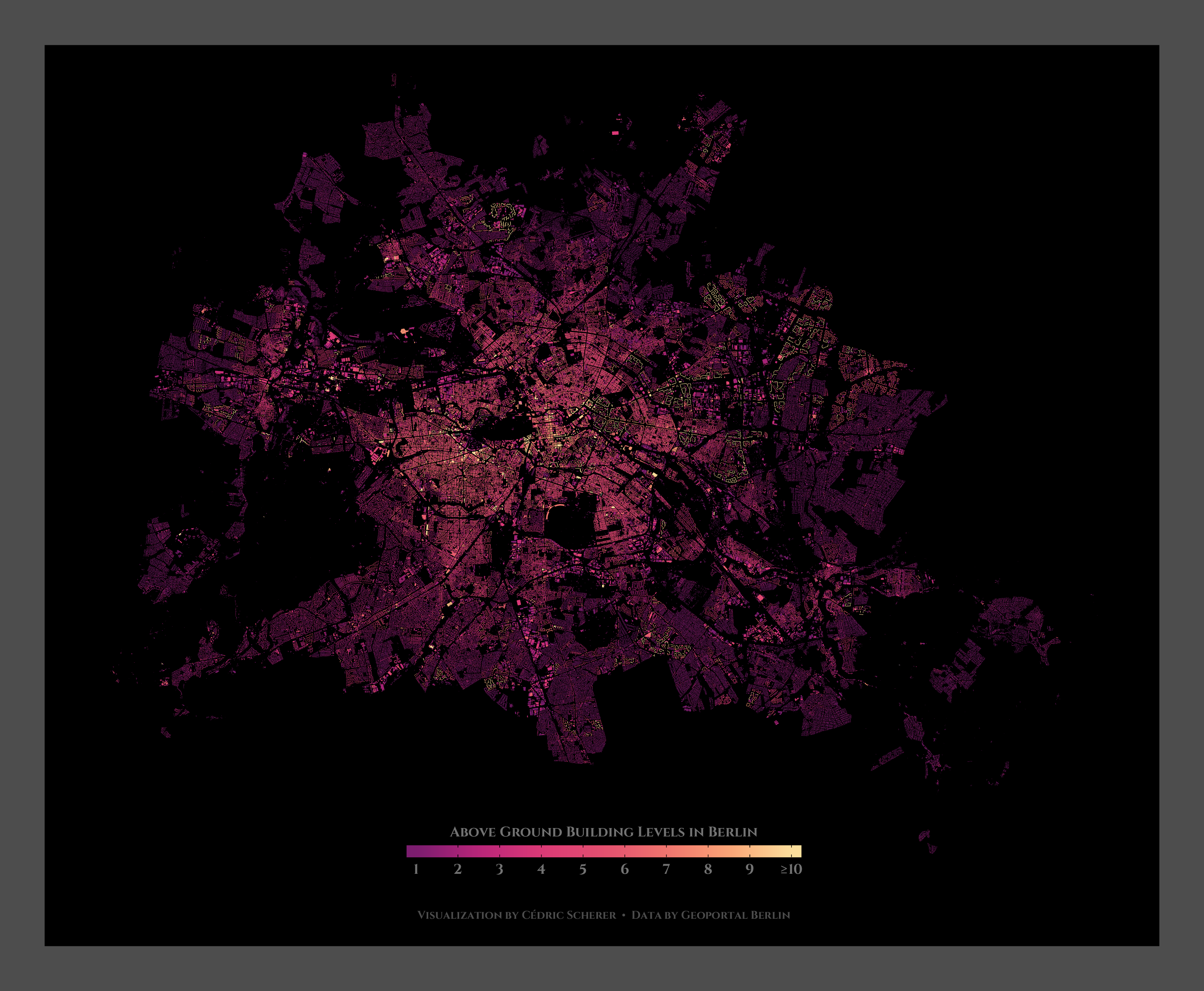
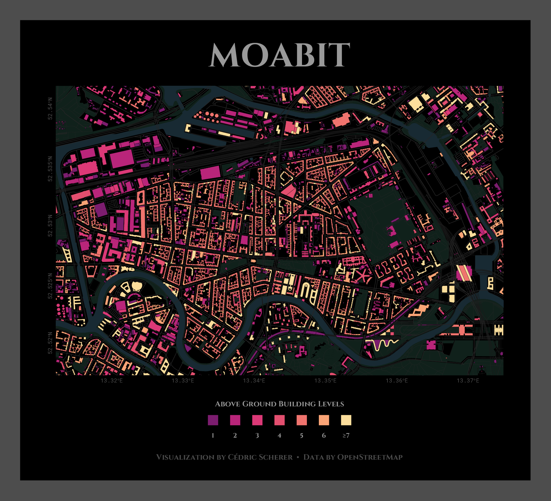 ... and here is a blank version of Moabit showing the buildings only
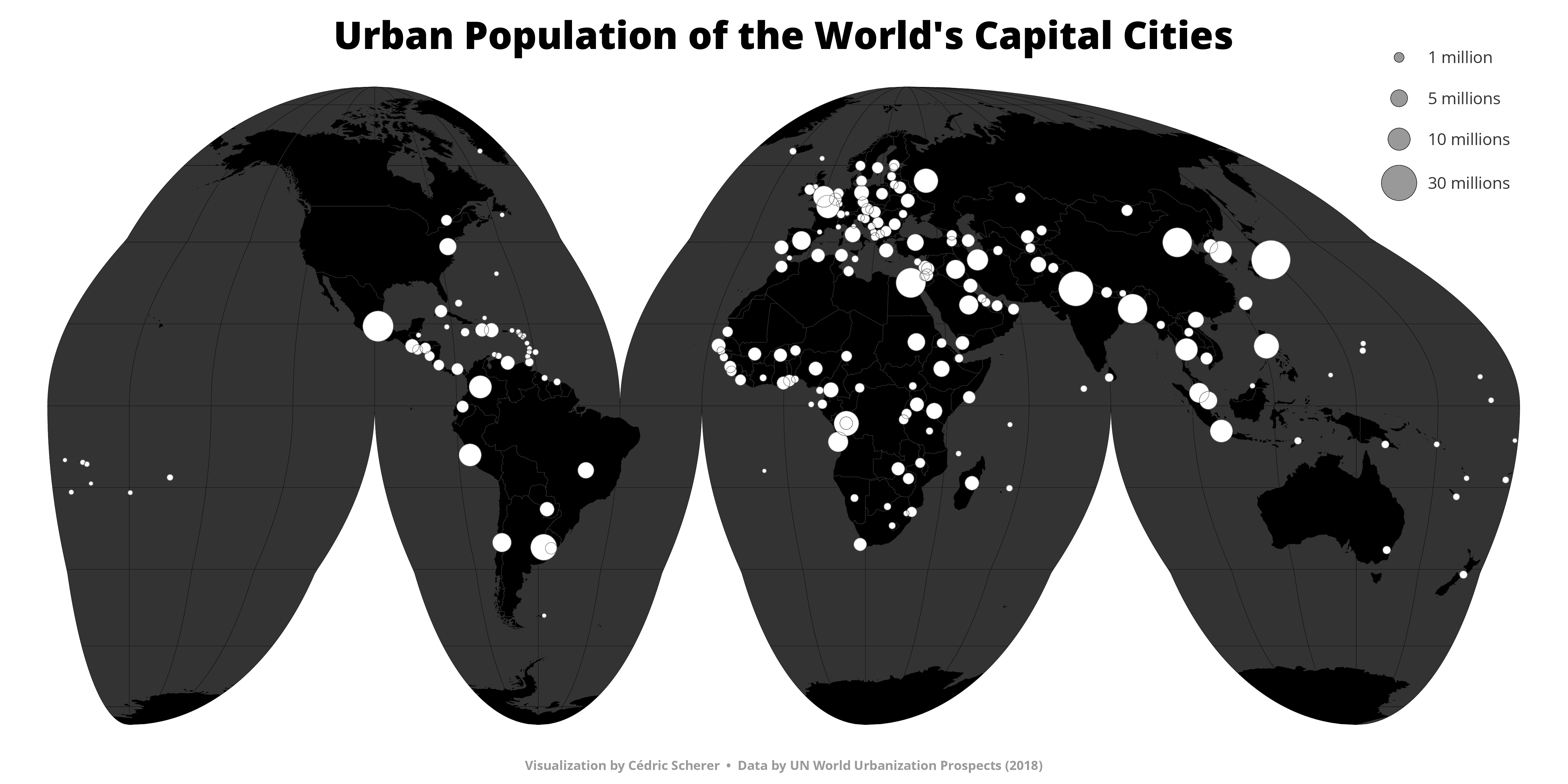
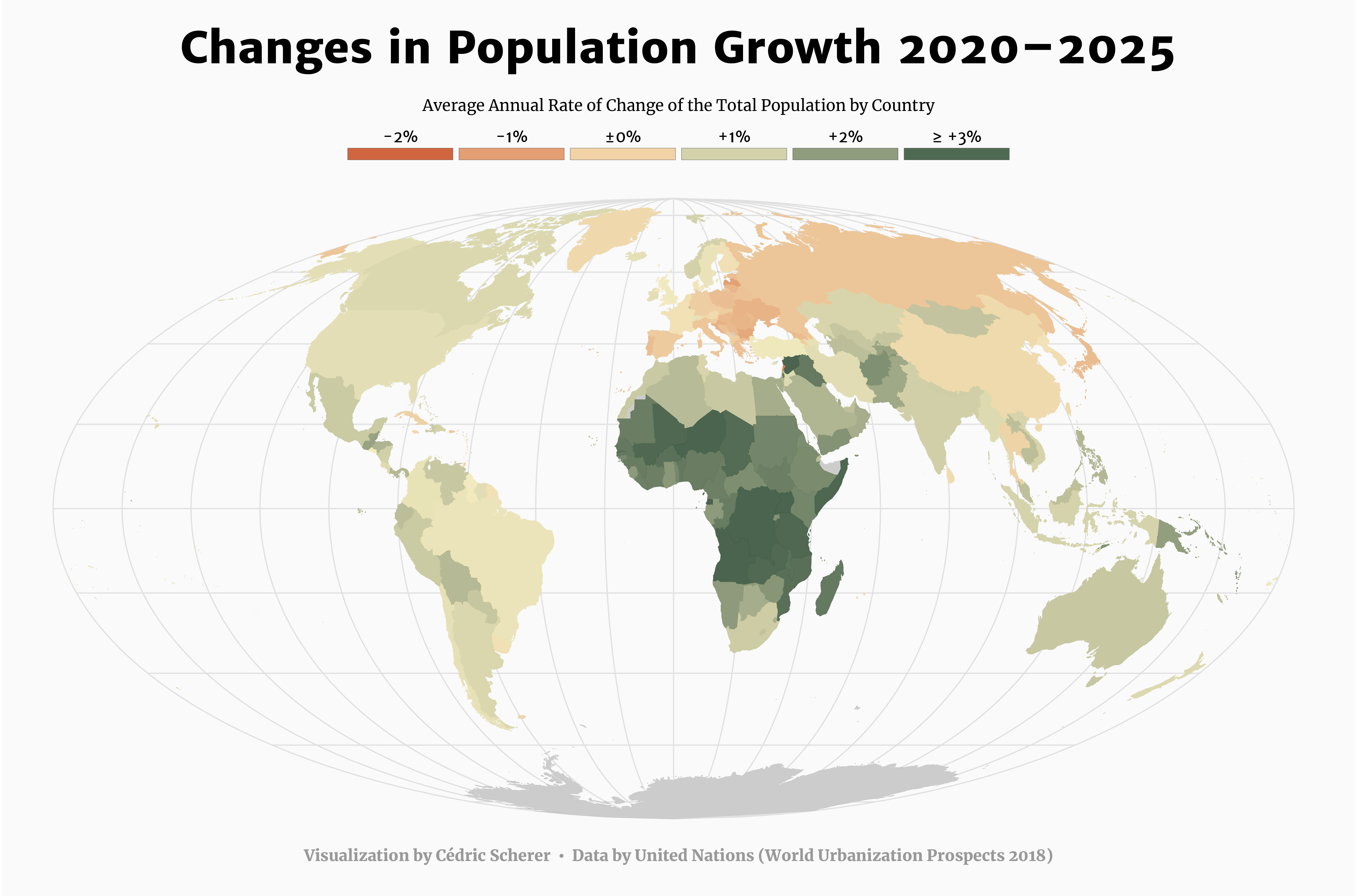
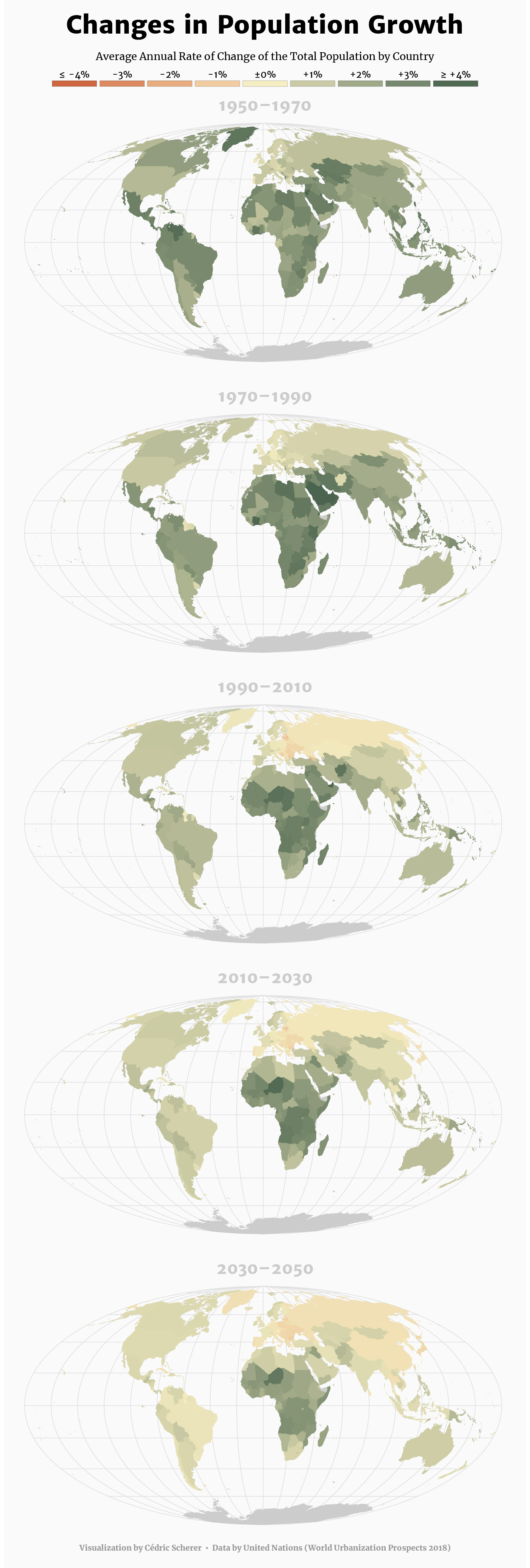
Day 23: Population
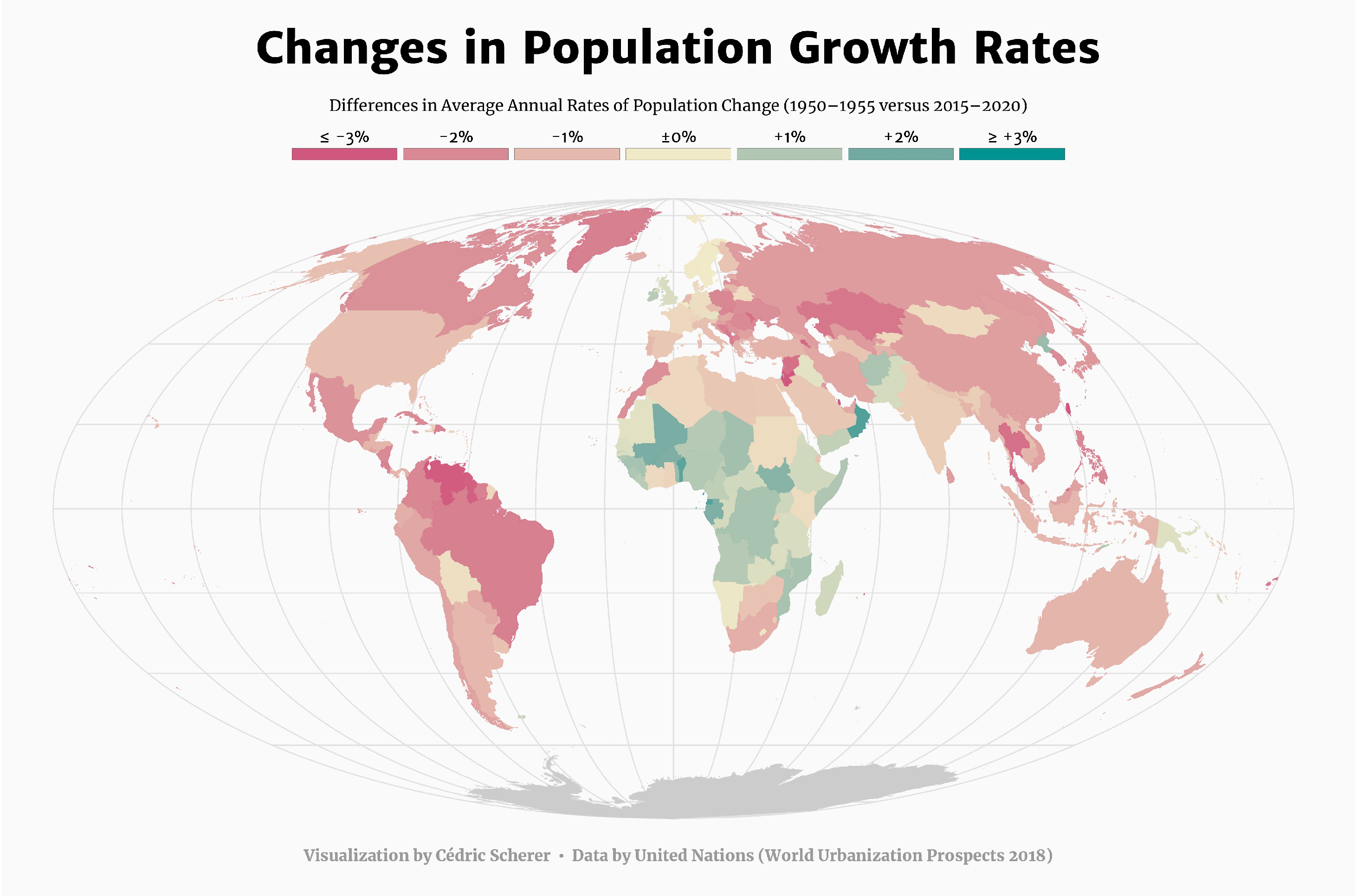 ... and a version showing the projections for the coming 5 years and for 20-year periods from 1950 to 2050
Day 24: Statistics
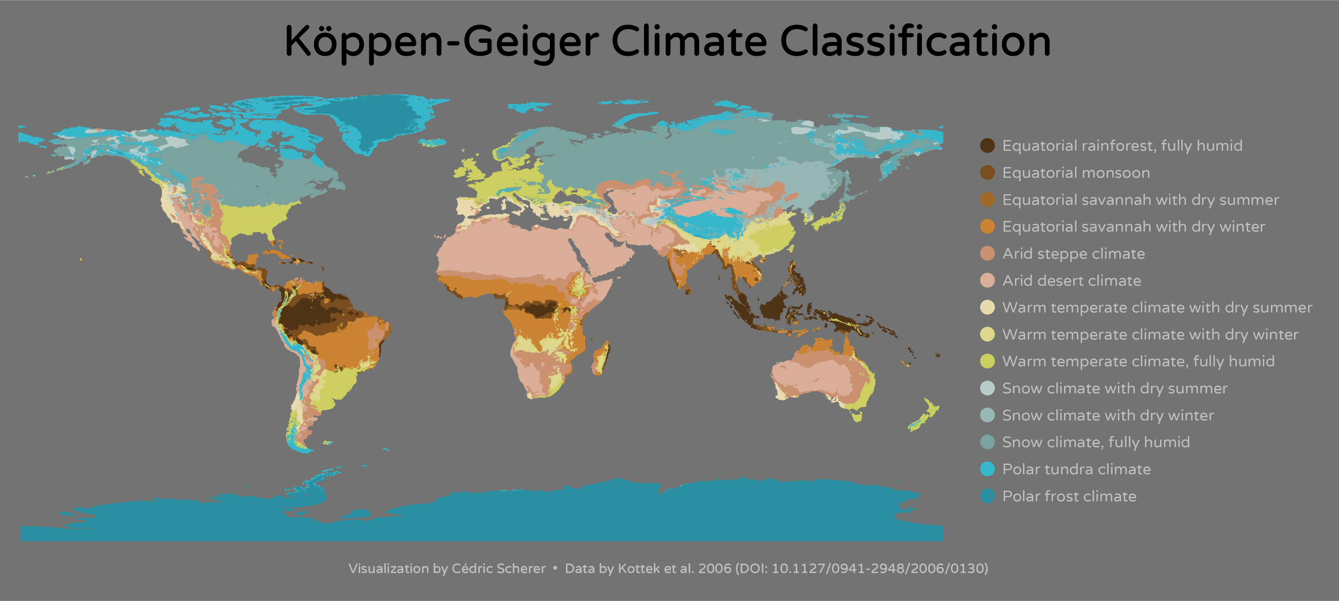
Day 25: Climate
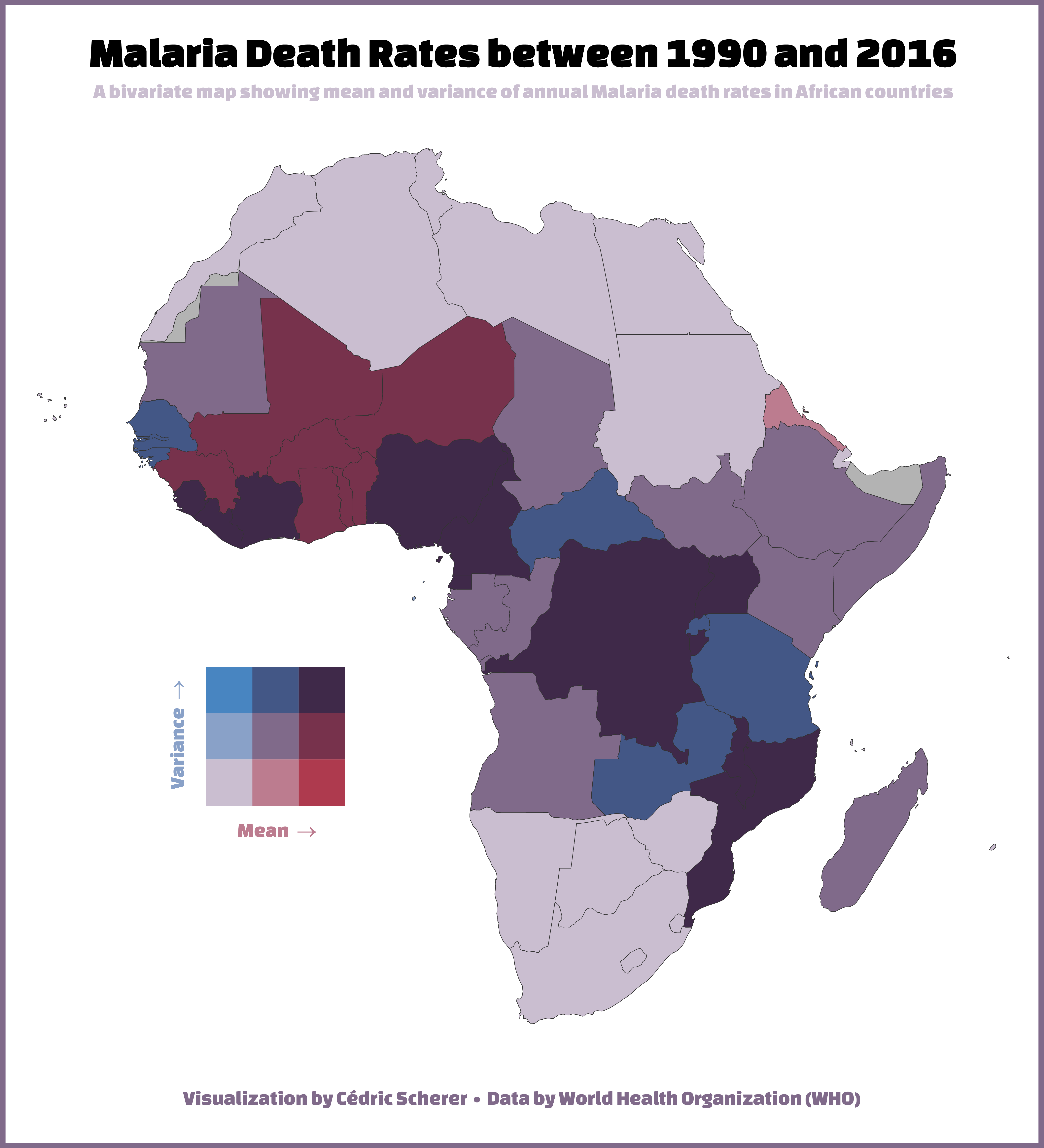
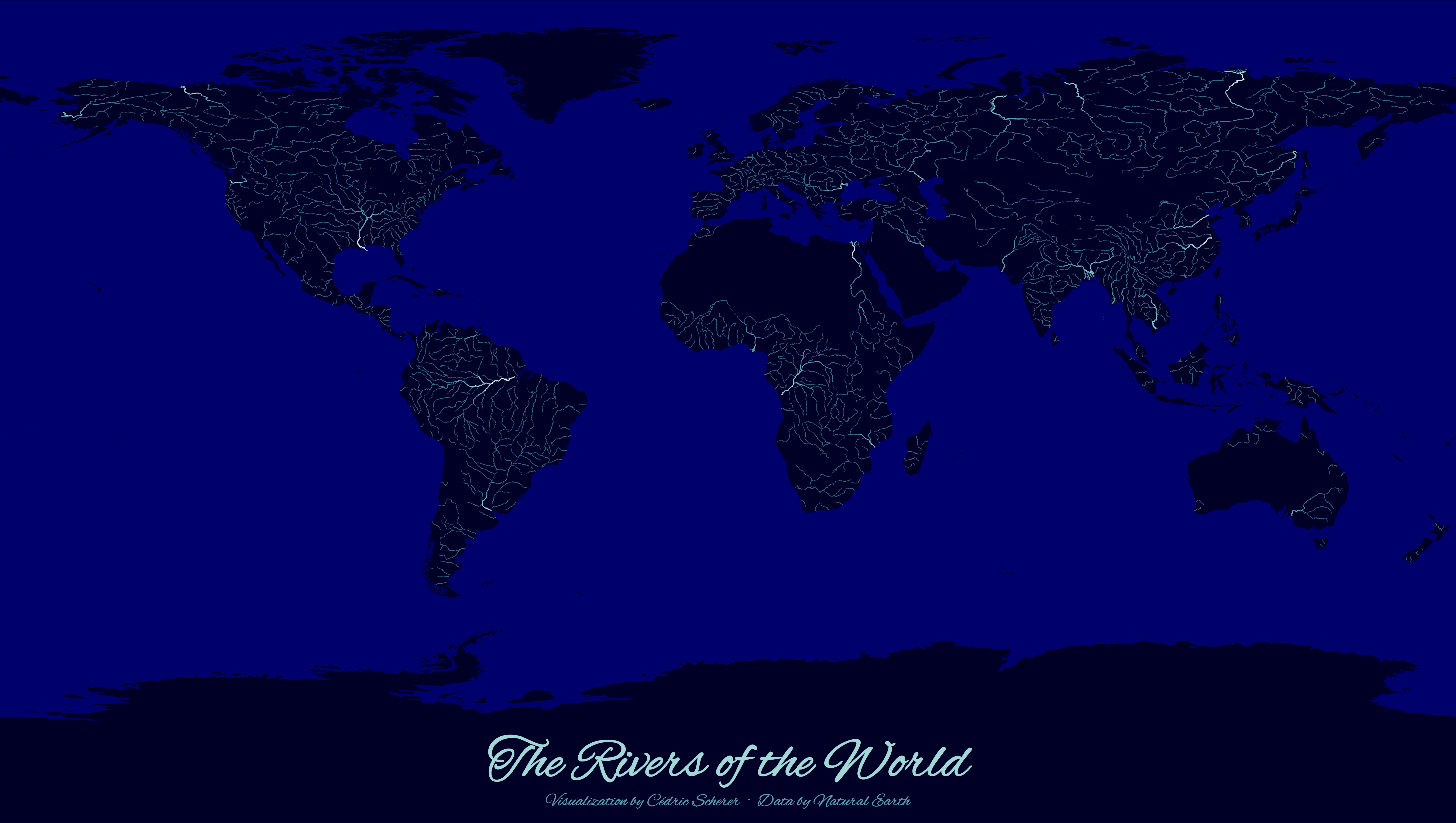
Day 26: Hydrology
Day 27: Resources
Day 28: Resources
coming soon? 🤷
Day 29: Experimental
Day 30: Home
coming soon? 🤷

